
Why?
The semi arid ecologies on the Cobar peneplain were predominantly open grass woodlands as a result of frequent fire - from Aborigines and lightning strikes - and the grazing characteristics of native fauna.


The advent of white settlers drove the Aborigines from the land, discouraged fires and introduced cattle and sheep.
Cattle and sheep’s hard hooves compacted the soil and their grazing styles seriously affected the native grasses by either pulling the plant out of the ground or eating in to the root system respectively.


What grew back were the plants the sheep and cattle did not want to eat (obviously) and these plants have come to dominate an estimated 40% of the 7.5 million hectare Cobar peneplain. When dominant they are called Invasive Native Scrub (INS)
Transitions: Merulya Station, Cobar
Source: A Vegetation Management Plan for Areas Invaded by Native Trees and Shrubs in the Cobar Peneplain. By Cobar Vegetation Management Committee 2006

1950
Before INS started encroaching. The line of trees in the background is the drainage line of Yanda Creek

1993
Invasive native Scrub dominates the landscape. Note the lack of ground cover. Photo by Alaistair McRobert (landholder) at approximately the same location as the photo from 1950

2000
After the INS was removed and cropping and pasture rotation, a method of reducing regrowth. Photo at the same location by Alastair McRobert (landholder).
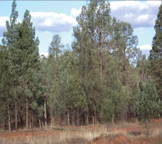
A short history of the INS problem

Open grassed woodland
In January, 1829, Charles Sturt and his exploration party camped at New Years Range located west of the Bogan River and to the southwest of the present village of Gongolgon.
To the westward, as a medium point, the horizon was unbroken, and the eye wandered over an apparently endless succession of wood and plain. ... We were obliged to return to the plain on which we had breakfast, and to sleep upon it."
SUMMARY: Sturt describes areas of open forest country with good grass growth, plains with open grasslands as well as quite dense scrubs probably of mulga. This description fits in with the notion that the Cobar Peneplain was substantially comprised of open forest / woodland country in a mosaic with more wooded areas thatwould periodically change as a consequence of being burned in wildfires. At no time does he describe any dense shrub understorey in the area.

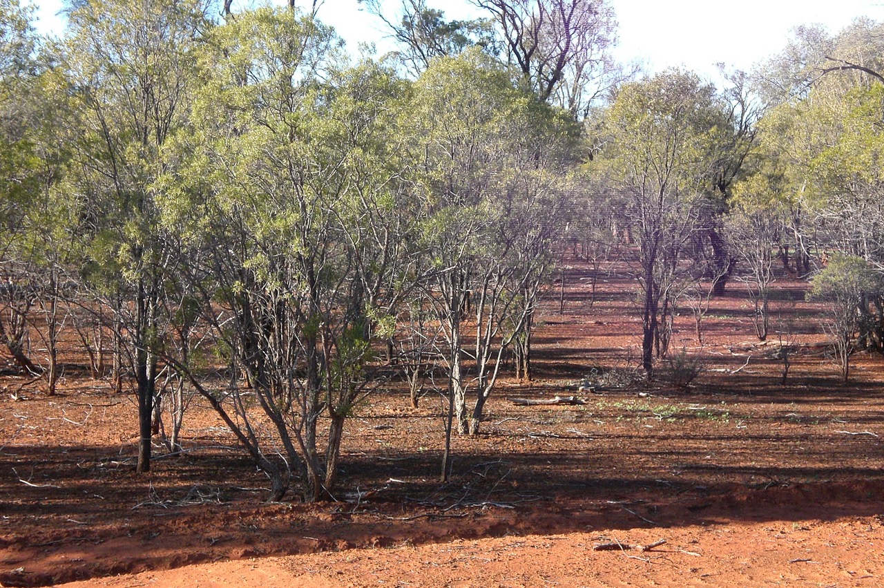
INS Impact

Invasive native Scrub IS a natural vegetation succession as a result of changed environmental pressures on vegetation, soils, wildlife and land use since European settlement.

The dense shrub layer prevents ground cover vegetation, due to shade, competition for water and compounds produced by the plant to prevent growth of other competing plants.

The traditional relatively frequent and ' Cool' grass fires kill the many of the plant seedlings that can become Invasive Native Scrub. This maintains a vegetative balance and diversity - a diversity which has evolved in large part to this burning regime.

When fires do occur in INS it can only burn through the crowns of the scrub. Many INS species have flammable oils in their leaves and the resulting fires are very hot and fast.
These hot and fast fires devastate wildlife and stock who still live in the area. To add insult to injury there is evidence that the hotter fires increase INS germination rates as compared to cooler grass fires. Source: Management-burning-of-invasive-native-scrub-principles.pdf

The lack of ground cover enables water run-off and poor infiltration resulting in eroded, crusted or hard setting soils. Source: Managing invasive native scrub to rehabilitate native pastures and open woodlands
Invasive Native Scrub also increases the acidity of soil, making regeneration even harder.
"INS act as ion pumps, redistributing alkalinity from the shallow soil depths both into the plant and to the soil surface as litterfall, which is subsequently exported via water and wind erosion from INS areas." Source

With disappearing grasslands and increased INS agricultural productivity has declined as shown in this graph on stock numbers from 1955 to 2005
Dense stands of INS also reduce habitat diversity. INS favours certain fauna species such as insectivorous birds, but the decline of grass- timber mosaics affects a range of other birds and wildlife. Source: Management-burning-of-invasive-native-scrub-principles.pdf
Image: Lack of ground cover under Eremophilla mitchellii (Budda) but grass germination in non invaded patches after good rain.

It is estimated 40% of the Cobar Peneplain's 7.5 million hectares has INS affecting the ecology and agriculture.
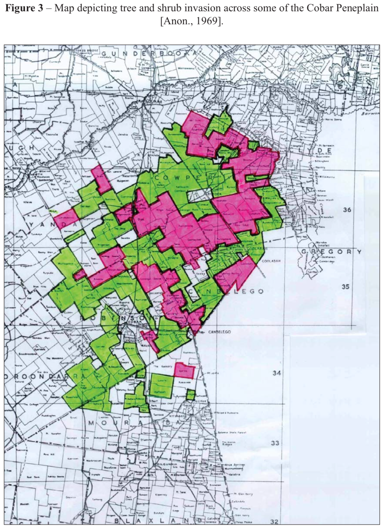
The latest surveys of INS extent we can find are from 1969. Our guess is that those who have the resources to do the surveys are thinking "the rowboat is going over the waterfall regardless so why bother measuring how fast the river is going?"
This was a map included in a NSW Govt report in 1969 in to INS impact.
The areas coloured green have 25% to 50% of the land within the property invaded by native trees and shrubs while those coloured red have >50% of the property invaded by trees and shrubs. Source: (pdf 4.9Mb)

We are not alone
Encroachment is common over much of the world’s arid and semi‐arid biomes. In the western United States, for example, dramatic increases in the densities of two shrubs in particular, Mesquite (Prosopis glandulosa) and Creosote Bush (Larrea tridentata), have largely been responsible for the conversion of extensive areas of former black grama (Boutelouaspp.) grasslands into dense shrublands Source: Impacts of shrub encroachment on ecosystem structure and functioning: towards a global synthesis
INS Control Methods
Long term Control?
Frankly, humans will only consistently control INS if there is a financial advantage to do so.
The only government strategy seems to be to tweak the vegetation legislation to make the approvals process easier - not cheaper - for landholders to control INS legally.
Landholders will and can only control INS if they see the financial gains outweigh the costs, pretty difficult when the cost of INS removal is often more than the land's economic value.
Sad but realistic.

Avoiding INS in the first place
This involves landholders;
- providing a regular fire regime
- using sensitive grazing practices
- 'grubbing' out of seedlings
- tilling soil to kill seedlings (then to plant crops)

Once INS is established
The only methods revolve around mechanical removal that is, bulldozers and chains. Considering we are talking about millions of hectares this is huge and daunting process.

Removal
Extensive removal and control of INS is regulated by the Government through an approvals process. See our page on INS removal here.
For all control methods;
The INS is pulled down via a humongous chain dragged along the ground between two bulldozers.
It is then pushed up in to a pile
and burnt! (this is where Renewed Carbon changes the equation)
Rehabilitation
Once the INS removed it is important to rehabilitate and maintain to prevent INS re-occurance
All these options have similar objectives which are:
- Re-establish native ground cover species.
- Improve soil health and condition and water quality.
- Create open areas across the landscape to provide a balanced habitat for endangered and other fauna and flora species.
- Ensure the economic viability for present and future generations.
Option 1- Cropping and Pasture Rotation
This management option has been the most successful in the rehabilitation of landscapes that are suffering from the encroachment of medium to dense INS on soil types that have appropriate capabilities for cultivation.

Option 2- Native Pasture Re-establishment
This management option has been successful in establishing native pastures that have been out-competed by INS. The ploughing option is critical on soil types that are capable of cultivation to remove the INS competition. This management option will require 20% of the rehabilitation area to be retained as INS to form a mosaic across the landscape.

Option 3- Native Pasture Re- establishment on Soil Types Without Cultivation Capabilities
The development process for this vegetation management option involves a number of different INS management techniques. Greater detail on the actual processes used is contained in Appendix 4 (of the document linked above)
